5G Transformation Hub
How 5G drones will help deliver digital twins
Autonomous drones could save infrastructure owners tens of billions of dollars a year
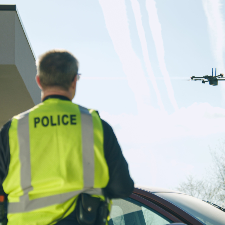
Skydio is preparing to use 5G to enable its autonomous inspection drones to coordinate their activities and quickly and reliably relay images and scans of critical infrastructure, and construction and accident sites to decision makers. Regular inspections will enable infrastructure owners to create digital twins of their assets, which can be used to guide proactive maintenance and design improvements.
Select a project
Contents
Challenge
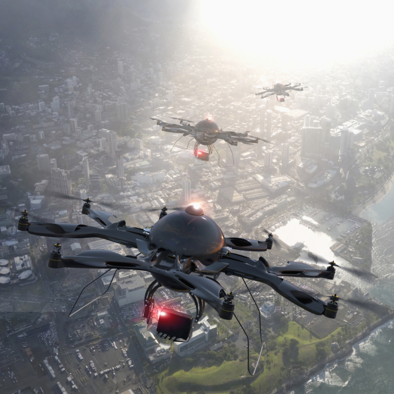
As more and more drones take flight they will need to be able to communicate directly with other drones and vehicles to coordinate missions. In some scenarios, drones will also need to be able to relay the images and scans they capture directly to decision makers.
Solution
Skydio is planning to use the low latency and reliable connectivity provided by 5G to enable its drones to relay images and scans directly to customers as required. As future releases of 5G are finalised, Skydio also intends to harness new features that will support direct communications between vehicles/drones and between vehicles/drones and surrounding infrastructure. These features will allow for faster communications and better coordination and decision-making.
Impact & Statistics
With support from 5G, drones will be able to become more autonomous and more capable, thereby boosting their value to the infrastructure sector. By enabling assets and infrastructure to be built and maintained better, regular drone inspections could save the public and private sector tens of billions of dollars each year.
Wider Implications
Autonomous drones will make it viable to routinely inspect and scan infrastructure, construction sites and accident sites. The resulting digital twins will enable building work to become more productive and allow for better resolution of insurance claims and legal action.
Stakeholders
Joe Enke, Director of Systems Engineering at Skydio, jenke@skydio.com
02
How 5G Drones Will Help Deliver Digital Twins
Autonomous drones could save infrastructure owners tens of billions of dollars a year
With drones becoming increasingly useful and capable, more and more of these flying robots are taking to the skies. As they work together to inspect critical infrastructure, and construction and accident sites, autonomous drones will need a way to communicate with each other quickly and reliably. That is where 5G will come in.
As the 5G standard evolves, it will incorporate specific features to support direct communication between vehicles, drones and robots, as well as roadside and air traffic control infrastructure. For California-based Skydio, a U.S. drone manufacturer working on autonomous flight, this direct communications capability – known as a sidelink - will ensure its vehicles can operate at maximum efficiency as a coordinated fleet.
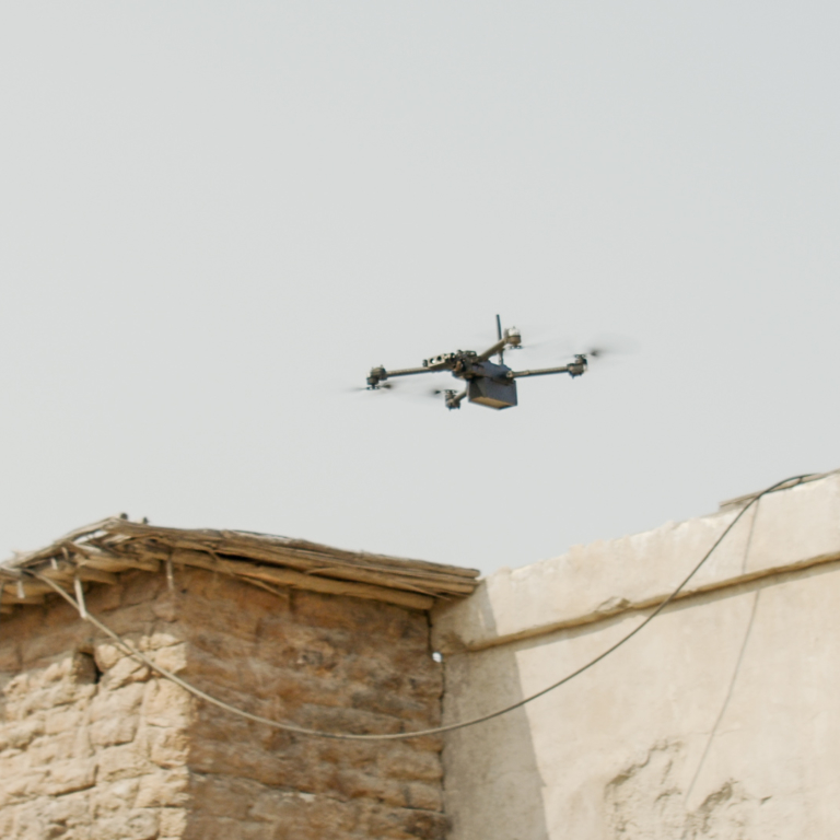
Today, drones are mostly flown within line of sight and typically on solo missions. But there is the potential to use fleets of autonomous drones to create and regularly update three-dimensional models (known as digital twins) of critical infrastructure, assets and construction sites. These models could be used to help detect any potential failures or scope for improvement. On construction sites, they could also help remote managers and clients track progress and the location and condition of equipment. Similarly, drones can give investigators a more complete view of crime scenes and accident sites.
But harnessing drones’ full potential will require them to fly beyond the controller’s visual line of sight. Today, in the U.S., this kind of mission generally requires regulatory approval on a case-by-case basis, making it difficult for remote inspection services to scale.
But Skydio is hopeful these rules will change: It is pioneering new concepts for advanced drone operations enabled by safe, autonomous systems that are unlikely to crash. As the regulatory ecosystem evolves, 5G technology will play a major role in enabling drones to coordinate their movements, keeping the skies safe and setting regulators’ minds at rest, while shifting the focus towards unlocking their positive potential.
“If you’re inspecting a 3,000 mile pipeline you probably aren’t going to have a controller that’s going to work for you the entire way down, so we want this to be completely autonomous,” explains Joe Enke, Director of Systems Engineering at Skydio. “There are going to be millions of drones out there that are making their own decisions. You’re going to want the capability of a constant and reliable connection.”
In cases where drones are working together to scan a complex structure, they will also need to communicate with each other to divide up the work efficiently. “You don’t actually build the plan of how you’re going to do a 3D scan at the beginning and then send everything out and get the data back,” says Joe Enke. “There’s a lot of coordination and the plan is built in real time as you go. Skydio has the AI-powered autonomous flight system to enable this level of highly complex real-time coordination between vehicles. 5G will be the communication protocol that allows us to put it to work.”
03
The tip of a very large iceberg
Today, most bridges, tunnels, pipelines, pylons and other pieces of infrastructure are inspected rarely. The costs are too high to conduct more frequent inspections. Traditional asset inspections performed by workers using bucket trucks, ropes, and ladders can also be dangerous, time consuming, inaccurate, and damaging for the environment.
Once the infrastructure to support remote operations by autonomous drones equipped with 5G is in place and the regulatory framework is more accommodating, there may be a massive increase in the number of inspections. “We’re probably at less than 1% today of what this can enable,” notes Joe Enke. “If you think of every bit of pipeline out there, every single bridge, every building, every construction site in the world, there’s just not enough time or people to inspect it. In the telecom industry, for instance, it is common to inspect certain towers every 12 years. 5G-enabled drones will make it possible to inspect towers every year - or every month - vastly increasing safety and performance.”
Regular drone inspections would allow for the creation of digital twins of all kinds of infrastructure and assets, which could allow for potential failures to be detected early. These models could also be used to make future infrastructure more robust. Artificial intelligence could, for example, analyse how these digital twins change over time and help to detect points of weaknesses in specific designs.
By enabling assets and infrastructure to be built and maintained better, regular drone inspections could result in significant savings for the public and private sector. As a result, digital twins could create tens of billions of dollars in value. “We’re just scratching the surface today,” says Joe Enke. “Over a five to 10 year timeframe, it would be safe to say we will see hundreds of thousands of drones deployed and billions of dollars spent.”
The business case for deploying digital twins could be even greater in developing markets, where infrastructure budgets can be limited, than in developed markets. Research and Markets projects the value of the global drone inspection and monitoring market will grow from US$9.1 billion in 2021 to US$33.6 billion by 2030. Brand Essence Research forecasts the global drone market will be worth U$40.9 billion by 2027, up from US$18.3 billion in 2020.
Founded in 2014, Skydio now provides autonomous drone inspection and “situational awareness solutions” to private and public sector customers in North America and Asia Pacific. It plans to expand geographically over time.
04
Robust regulatory frameworks required
The speed at which the automated inspection market develops in different regions of the world will depend in part on how quickly regulatory frameworks evolve. There are three key regulatory dimensions. One relates to traffic management requirements – how drones need to communicate with each other and air space controllers. The second dimension relates to how autonomous drones can be and the extent to which they can fly beyond visual line of sight. The third dimension is the radio frequencies that drones can use to communicate with each other, infrastructure and controllers.
When it comes to air traffic management and drone autonomy, altitude is a key consideration. “Unlike traditional drones, which fly at high altitudes to avoid crashing into structures, Skydio’s autonomous drones can be flown within inches of--and even inside--the most complex structures,” says Brendan Groves, Vice President for Regulatory & Policy Affairs at Skydio. “That technology opens up regulatory possibilities. The FAA (in the U.S.) and global regulators have begun to unlock the airspace from the ground up, allowing small, smart drones to fly beyond line of sight at low altitudes in ways that provide extraordinary commercial value.”
In some markets, the availability of wireless spectrum is also a significant issue. Once drones are equipped with 5G, they could use the spectrum available to that technology, making it easier to integrate these flying robots into the wireless frequency landscape. Ideally, drones will be able to use the same 5G frequencies worldwide, creating economies of scale for the sector.
05
Automatic scanning could be a game changer
Skydio says autonomous drone technology is making frequent site inspections viable. In the past, “the complexity, crash risk, and training costs of manual drones have greatly limited their ability to generate useful data,” Joe Enke says. “Manual drones require cumbersome mission planning, constant access to GPS, and intense focus from an elite pilot to avoid collisions. For professional crews trying to get their inspection job done,the barriers to adopt the technology can be quite difficult to overcome.”
In June 2021, Skydio launched its adaptive scanning software, Skydio 3D Scan, which is designed to enable its drones to automatically map and capture the photos needed to thoroughly document and enable the processing of a detailed 3D digital model. This model could be of an infrastructure asset, such as a bridge or tower, or a scene, such as a construction site or the scene of an accident or crime. All the drone operator needs to do is set the boundaries of the site or structure the drone needs to scan, and then the drone does the rest: It automatically avoids obstacles and takes photos from all the angles required to document every element of a scene or asset with sub-millimetre precision, according to Skydio.
Skydio says it tested the 3D scan technology through months of trials with multiple customers, including Sundt Construction, the North Carolina Department of Transportation and the Boston Police Department. The trial participants reported up to 75% faster data capture, 50% greater inspection team output, and 30% lower re-inspection rates during the trial period, according to Skydio.
“Our secret sauce is very much our autonomy software,” says Joe Enke. The software continually maps the drone’s surroundings in real-time by processing the images collected by six 4K resolution navigation cameras mounted on top and bottom of the drone. The computation required to autonomously navigate and position the drone takes place on-board in real-time using the AI-driven software. The images captured by the drone’s main camera through the 3D scanning process can be used to keep historical records of the state of assets, to visually inspect the asset, or can be transferred to third-party photogrammetry services, which then create a highly-detailed 3D model of the site.
As well as supplying the hardware, Skydio sells the automatic scanning software on a subscription basis. The software can be purchased as an optional add-on, beginning at US$2,999 per drone per year. Joe Enke notes this capability makes it feasible to conduct “daily or even hourly” inspections that allow for the creation of a dynamic 3D model (known as a digital twin) that can be used by decision makers.

Joe Enke
Director of Systems Engineering at Skydio
06
Direct connection to decision-makers
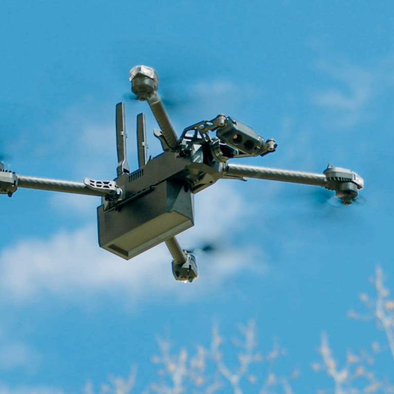
Skydio has plans to add LTE/5G connectivity to its drones. To that end, it is working with chip supplier Qualcomm, which also provides its Wi-Fi chipsets, together with some of the camera and robotic systems used in Skydio’s drones.
Initially, the LTE/5G connectivity will be used to relay the images and scans a drone captures directly to relevant decision makers. For example, in the case of an accident or a live crime scene, the drone could use a cellular connection to relay real-time images directly to the emergency services.
There may also be scenarios when a company wants real-time aerial views of a construction site or another asset to help inform urgent decisions, such as when to schedule a major delivery, or for security purposes. If an alarm goes off, for example, a drone can check what is going on in the vicinity of a site.
Today, Skydio employs point-to point Wi-Fi-based connectivity to enable communications between the drone and a controller over distances of up to 6km. The controller can then connect to the Internet (through LTE or Wi-Fi) to relay near realtime images to decision-makers.
Once they are equipped with LTE/5G, Skydio’s drones will have greater flexibility and reliability. “The ultimate solution is to have both Wi-Fi and 5G all the time, and the reality is that you’ll have some of these things, some of the time,” says Joe Enke. “LTE, 5G and Wi-Fi complement each other very well. They are the basic building blocks of your communication. But similar to all communication, having anything talk to everything else instantaneously is the ideal. 5G solves a lot of these problems for a lot of different use cases.”
In future, Skydio may harness the high capacity provided by 5G networks running in millimetre wave (mmWave) spectrum to enable customers to offload all the imaging data captured by its drones. Today, that task is typically performed over Wi-Fi, but millimetre 5G may prove to be faster and more efficient.
The addition of 5G could also give Skydio a low latency connection, which Joe Enke describes as “critical.” He also lauds 5G’s ability to guarantee a quality of service, together with smoother handovers and the greater support for aerial connectivity than can be achieved with future revisions of 5G/LTE. Ahead of the future releases of 5G standards, Skydio is working with Qualcomm to further optimise cellular technology for use by drones.
“A lot of improvements of the features with 5G are really interesting for drone and aerial use cases and just robotics in general,” says Joe Enke. “Some of the 5G features coming along for cars and vehicle communications, with sidelink channels, is all very promising, but it’s not exactly what you would build for drones. So we want to sort of push and tweak and see if we can get that to work a little bit better for drone use cases.”

07
Moving drones forward in leaps and bounds
Drone technology is still developing quickly across multiple fronts. “Drones are extremely interesting products because there’s about 25 relevant technology subsystems under the hood,” says Joe Enke. These subsystems include the cameras, the positioning systems, the sensors, the wireless technologies, the batteries as well as advanced materials and thermal management. “Some of the most important are simply the compute engines themselves,” explains Joe Enke. “We’ve seen extremely rapid and massive improvement in the application processors. They are being optimised to make it possible to run neural compute and AI algorithms in real time.”
Today, Skydio is integrating its software closely with these application processors. But Joe Enke expects drone platforms to evolve over time to enable the software to handle more and more of the computational tasks without relying on customised hardware. For battery-powered drones, as with mobile phones, it is critical that the application processors are frugal with power.
Indeed, the ultimate value of drones could depend in large part on developments in battery technology: the longer drones can remain in the sky, the more they can do. As batteries are used to power everything from cars to aircraft, huge sums are being invested in improving their efficiency.
As all these technological subsystems improve, Skydio expects drones and robots in general to be very widely deployed over the next decade. “I think on a 10-year horizon, robots will be doing a lot more things in our daily lives as well as our commercial lives,” Joe Enke concludes.

Joe Enke
Director of Systems Engineering at Skydio
08
About
About the GSMA
The GSMA is a global organisation unifying the mobile ecosystem to discover, develop and deliver innovation foundational to positive business environments and societal change. Our vision is to unlock the full power of connectivity so that people,
industry, and society thrive. Representing mobile operators and organisations across the mobile ecosystem and adjacent industries, the GSMA delivers for its members across three broad pillars: Connectivity for Good, Industry Services and Solutions, and Outreach. This activity includes advancing policy, tackling today’s biggest societal challenges, underpinning the technology and interoperability that make mobile work, and providing the world’s largest platform to convene the mobile ecosystem at the MWC and M360 series of events.
For more information, please visit the GSMA corporate website at www.gsma.com.
Follow the GSMA on Twitter: @GSMA.
GSMA 5G Transformation Hub
The GSMA 5G Transformation Hub is a source of information on some of the most innovative 5G solutions in the world. This portal contains case studies detailing design, benefits, key players, measured value and the future impact of scaling up these 5G solutions worldwide. The 5G Era is now firmly established and this family of standardised GSM technologies, including mmWave, are being rolled out successfully across the globe. The GSMA 5G Transformation Hub, launched at MWC Barcelona in 2022, provides details of how 5G is best placed to deliver real value for a range of key sectors including manufacturing, energy, transportation, media and live entertainment, smart cities and construction.. Many more case studies will be added, in the coming months, covering even more industries and the GSMA is asking Members to nominate innovative 5G case studies to add to this global digital showcase. The 5G Transformation Hub and this particular Case Study are both sponsored by Qualcomm.
About this case study
This case study is for information only and is provided as is. The GSM Association makes no representations and gives no warranties or undertakings (express or implied) with respect to the study and does not accept any responsibility for , and hereby disclaims any liability for the accuracy or completeness or timeliness of the information contained in this document. Any use of the study is at the users own risk and the user assumes liability for any third party claims associated with such use.
The case studies are no longer available.